படிமம்:Pacific elevation.jpg
Jump to navigation
Jump to search
இந்த முன்னோட்டத்தின் அளவு: 221 × 210 படப்புள்ளிகள் . மற்ற பிரிதிறன்: 2,500 × 2,370 படப்புள்ளிகள் .
மூலக்கோப்பு (2,500 × 2,370 படவணுக்கள், கோப்பின் அளவு: 899 KB, MIME வகை: image/jpeg)
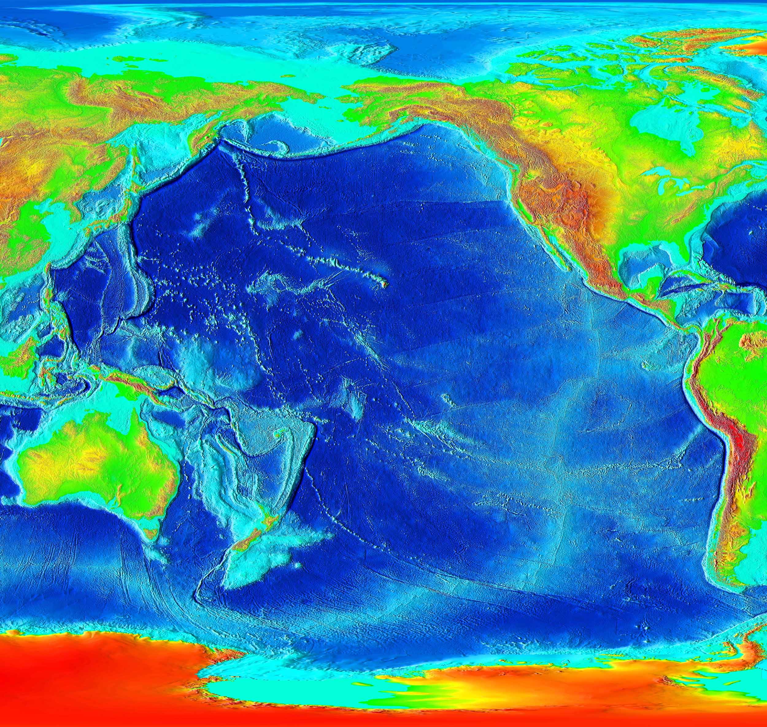
சுருக்கம்
Elevation of the Pacific ocean
Source: ETOPO2v2, a digital database of seafloor and land elevations created by the World Data Center for Geophysics & Marine Geology (Boulder, CO), National Geophysical Data Center, NOAA.
அனுமதி
This image is in the public domain because it contains materials that originally came from the U.S. National Oceanic and Atmospheric Administration, taken or made as part of an employee's official duties.
|
derivative works
Derivative works of this file: Pacific elevation2.jpg
கோப்பின் வரலாறு
குறித்த நேரத்தில் இருந்த படிமத்தைப் பார்க்க அந்நேரத்தின் மீது சொடுக்கவும்.
| நாள்/நேரம் | நகம் அளவு சிறுபடம் | அளவுகள் | பயனர் | கருத்து | |
|---|---|---|---|---|---|
| தற்போதைய | 03:41, 7 மார்ச்சு 2006 | | 2,500 × 2,370 (899 KB) | wikimediacommons>Interiot~commonswiki | Elevation of the Pacific ocean Source: http://www.ngdc.noaa.gov/mgg/image/2minrelief.html |
கோப்பு பயன்பாடு
பின்வரும் 2 பக்கங்கள் இணைப்பு இப் படிமத்துக்கு இணைக்கபட்டுள்ளது(ளன):