படிமம்:Sea of Marmara map.png
Jump to navigation
Jump to search
இந்த முன்னோட்டத்தின் அளவு: 280 × 157 படப்புள்ளிகள் . மற்ற பிரிதிறன்: 1,336 × 748 படப்புள்ளிகள் .
மூலக்கோப்பு (1,336 × 748 படவணுக்கள், கோப்பின் அளவு: 334 KB, MIME வகை: image/png)
சுருக்கம்
| விளக்கம் |
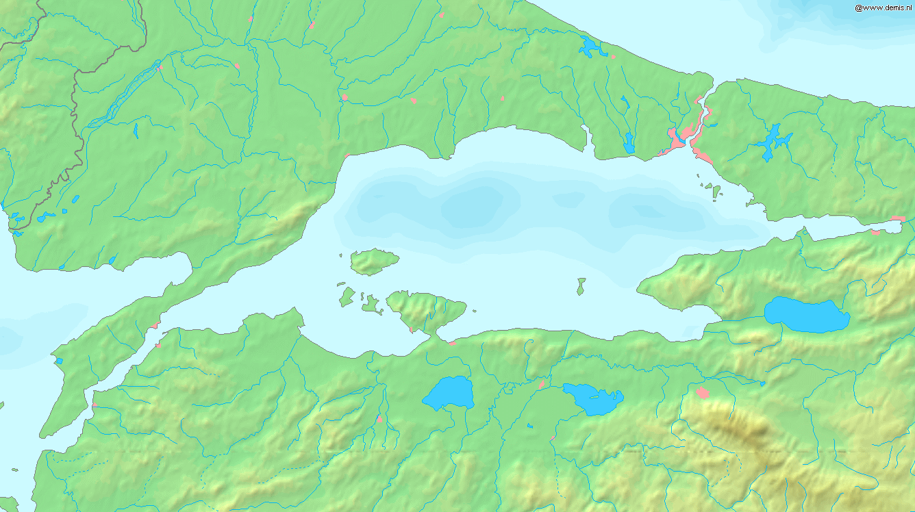
English: Map of the Sea of Marmara. Bounding box West 26°, South 39.8°, East 30°, North 41.5°. Español: Mapa del Mar de Marmara Français : Carte du détroit des Dardanelles (à la gauche), de la mer de Marmara (au centre) et du détroit du Bhosphore (à la droite). Coordonnées des limites du rectangle : West 26°, South 39.8°, East 30°, North 41.5°. |
||||
| நாள் | |||||
| மூலம் | Website Demis.nl | ||||
| ஆசிரியர் | Website Demis.nl | ||||
| அனுமதி (இக்கோப்பை மீண்டும் பயன்படுத்துதல்) |
|
||||
| ஒத்தக்கோப்பு | Derivative works of this file: Sea of Marmara map hr.svg |
கோப்பின் வரலாறு
குறித்த நேரத்தில் இருந்த படிமத்தைப் பார்க்க அந்நேரத்தின் மீது சொடுக்கவும்.
| நாள்/நேரம் | நகம் அளவு சிறுபடம் | அளவுகள் | பயனர் | கருத்து | |
|---|---|---|---|---|---|
| தற்போதைய | 17:37, 6 செப்டெம்பர் 2005 | | 1,336 × 748 (334 KB) | wikimediacommons>Mats Halldin~commonswiki | Map of the Sea of Marmara Bounding box West 26°, South 39.8°, East 30°, North 41.5°. {{demis-pd}} Category:Maps of Turkey |
கோப்பு பயன்பாடு
பின்வரும் பக்க இணைப்புகள் இப் படிமத்துக்கு இணைக்கபட்டுள்ளது(ளன):