படிமம்:Xinjiang Internment Map, US-Aus Gov Assessment.jpg
Jump to navigation
Jump to search
மூலக்கோப்பு (2,048 × 1,267 படவணுக்கள், கோப்பின் அளவு: 150 KB, MIME வகை: image/jpeg)
சுருக்கம்
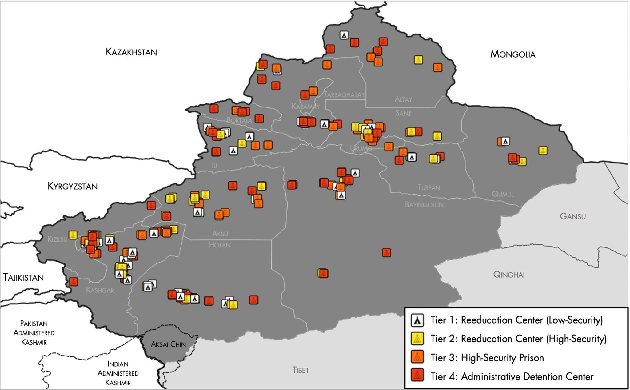
| விளக்கம் |
English: Map of the Xinjiang Internment Camps created by the RAND Corporation based on data collected by the US National Geospatial Intelligence Agency and the Australian Strategic Policy Institute. Open source here. |
||||||
| நாள் | |||||||
| மூலம் | https://www.tearline.mil/public_page/xinjiang-nighttime-1/ | ||||||
| ஆசிரியர் | National Geospatial Intelligence Agency, using data from the Australian Strategic Policy Institute, and administrative boundaries from GADM. | ||||||
| அனுமதி (இக்கோப்பை மீண்டும் பயன்படுத்துதல்) |
|

கோப்பின் வரலாறு
குறித்த நேரத்தில் இருந்த படிமத்தைப் பார்க்க அந்நேரத்தின் மீது சொடுக்கவும்.
| நாள்/நேரம் | நகம் அளவு சிறுபடம் | அளவுகள் | பயனர் | கருத்து | |
|---|---|---|---|---|---|
| தற்போதைய | 05:05, 2 மே 2021 | சிறுதோற்றம் இல்லை | 2,048 × 1,267 (150 KB) | wikimediacommons>Abovfold | Uploaded a work by {{w|National Geospatial Intelligence Agency}}, using data from the {{w|Australian Strategic Policy Institute}}, and administrative boundaries from {{w|GADM}}. from https://www.tearline.mil/public_page/xinjiang-nighttime-1/ with UploadWizard |
கோப்பு பயன்பாடு
பின்வரும் பக்க இணைப்புகள் இப் படிமத்துக்கு இணைக்கபட்டுள்ளது(ளன):